The car is packed, the tank full of gas. We’ve got music and “The Everything Store” on Audible to listen to. I run through my mental check list as Dave starts the engine…Cell phones, charging cord, auxiliary cord, water, lunch, handicapped placard, sunglasses. I think we’re ready. If we don’t have something, we’ll stop and buy it. I giggle as I look over my shoulder to make sure the garage door is closed as we both remember a text from our neighbor a few years ago asking if we’d left home yet. “Yes”, I texted back. “6 hours ago why?” Quick return, “Your garage door is open.” That’s what happens when you get excited to hit the road and get out and go. With Dave wearing a long sleeve shirt and me in summer-weight short sleeves, it’s just possible we may be able to agree on keeping the AC on.
Truckee is 561 miles from San Diego, via US 395, about a ten hour drive if traffic and weather co-operate. Dave could do it all in one day, but since I don’t like sitting that long, we break it up by staying in Bishop over night. The on-ramp to I-5 North takes us onto an eight lane highway which transports thousands of people 24 hours a day. San Diego is, after all, the eighth largest city in the United States, a fact that is both good and bad.
It takes two hours of freeway mentality to get through the nasty Riverside interchange, skirt San Bernardino, wind up the Cajon Pass, to the turn-off for US 395—one of our favorite roads. My dream is to someday take every turn-off from Olancha to the Nevada border, and see where they go. The numbing drive finally gets us to Kramer Junction where we start enjoying ourselves…get gas, chocolate chip cookies at the Roadhouse Restaurant, pit stop for us and the dogs.
The vast Mojave Desert stretches around us now with Joshua Trees, cholla cactus and cresosote bushes plus lots of creatures we can’t see. About four hours from home, the southern end of the Sierra mountains come into view. We watch the stark, jagged, rocky ridge grow in height as we speed north at 75-80 miles an hour, leapfrogging 18 wheelers on long stretches of two lane road.
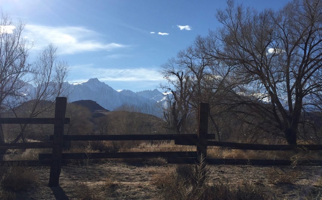
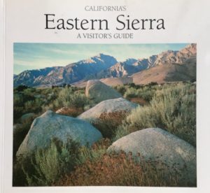
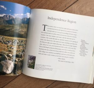
Aah…395. Probably our favorite road in the world. As a teenager, I could recite the names of towns heading north on the way to skiing at Mammoth. Olancha, Lone Pine, Indepence, Big Pine, Bishop. But even more interesting are the uninhabited places most people see only as names on maps. Coso Petroglyphs with 100,000 rock paintings up to 10,000 years old. Alabama Hills, a filming site for dozens of western movies and television shows. Manzanar, the first wartime internment camp that imprisoned over 11,000 Japanese Americans—a sobering landmark. Owens River, which fed into the Owens Lake that has been dry since about 1913 when businessmen diverted the water to the Los Angeles Aqueduct. It’s incredible that only 135 miles separate Mt Whitney from Badwater in Death Valley, the highest and lowest points in the continental United States. A book published in 1991 is still my favorite go-to resource for this highway—”California’s Eastern Sierra, A Visitor’s Guide.”
Every time we drive through Lone Pine, I relive my two backpacking trips up Mt Whitney—in my first year of college with an ex-boyfriend, and then with friends during medical school. In my minds eye I see “Grandma Whitney,” Hulda Crooks, the woman from Loma Linda, California, who climbed Mt Whitney 23 times between the ages of 65 and 91. I was 12 years old the first time she made the ascent and she was one of my heroes as every year she repeated the climb.
We hurry on, trying to stay at 75 miles per hour, hoping not to attract the attention of the CHP that patrols the back side of the Sierras. Our destination is Bishop, where we choose to stay overnight on every trip to Truckee, solely so we can have sushi at Yamatani Japanese Restaurant and Sushi Bar. I know what you’re saying…raw fish in Bishop? Why would anyone do that? Well, because it’s one of the best sushi restaurants in California. Robbie Tani will tell you they get the same fresh fish from all over the world that you’d get in Los Angeles or San Francisco…airplanes are the answer.
While sipping on our drinks we pull up the towns north of us on our weather apps. We’ve known all week that we’re heading into a big storm, several feet of snow are expected in the Sierras over the next few days. Dave’s 4-Runner has four-wheel drive, all-terrain tires and we carry chains. We have food in an ice chest and warm clothes. In two hundred miles tomorrow, we will cross five mountain passes, the highest being Conway Summit at 8,138 ft. Over the years we’ve driven this stretch of road as slow as 35 mph for hours in 4 wheel-drive on unplowed roads several times. It can be nerve-wracking but also other-earthly and serene, in the silence only heard with heavy snow falls. I usually have a tight grip on the door, hoping we won’t slide.
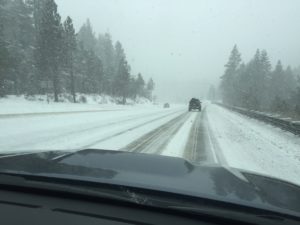 The next morning snow starts falling south of Mammoth. An hour after leaving, Dave slows and shifts into 4-wheel drive. Soon we are grateful to be crawling along behind a snow-plow. Passing through Lee Vining we have cell reception long enough to see that I-80 is now closed in both directions, effectively blocking traffic from Reno to Sacramento. This is a major problem. Maybe not for us on this trip—but certainly for the 30,000 vehicles that are reported to travel over the Donner pass every day. (Interstate 80 Annual Average Daily Traffic (AADT) from Interstate-Guide.com) Our best hope to get to Truckee now is to sneak in via US 50 and go along thet eastern shore of Lake Tahoe.
As we creep along, Dave and I do a little time-warp travel to the winter of 1846-47, the winter the Reed and Donner families took a shortcut through the desert on their way to California. Jacob Donner was a well-to-do, sixty-year old man when he left Missouri with his family, household belongings and covered wagons.
Dave and I are in our sixties, and that’s where the similarities stop. Starting from Springfield, Illinois, they had about 120 days to cover 2,200 miles of trails with covered wagons, which translates into nearly twenty miles a day. At times they had to take the wheels off their wagons and pull them up steep trails. Reaching the eastern Sierras near Truckee meadows (current-day Reno) late in the season, they were doomed by an early start to winter and an eventual snow accumulation of 22 feet. Only 48 of the 87 people survived that winter. The Donner Party, Donner Lake, Donner Pass, Donner Summit—all appelations memorializing the tragedy that befell Jacob Donner and Joseph Reed’s families.
Today we routinely travel 550 miles in ten hours. Weather predictions aid our planning. When slowed by snow, we put our car in 4-wheel drive and slow down to 25-30 miles an hour. Hundreds of 18-wheeler trucks transport goods over the Donner Summit. We don’t take this trip lightly. 170 years after the Donner Party, we know Mother Nature can still have the upper hand.
By the way, check out my Reference page for other outdoor resources.
Loved this piece! Life is about the journey not just the final destination as illustrated by this road trip, full of familiarity and adventure.
Thanks Colette. You are a role model for adapting to life’s ups and downs. Thanks for being my friend.
Thank you so much for putting us in the front seat with you as you pass through some of the best quiet or small places in California. Appreciate being reminded of legendary figures (Donner Party & Grandma Whitney), sushi dining recommendations, environmental milestones (Owens Lake transition), landscape changes from clogged freeways to snowy summits, and the classic attributes of good ole road trips. Your blog allows us to “get out and do it with you”! Looking for the next trip.
You and I’ve done a lot of these things together. Let’s keep on getting out and going…even if we are a little slower these days.
What a wonderful reminder of favorite places in California. You made it possible to travel, again, to places we love. Your description reminds me to absorb the scenery as I drive 12 hours from Mobile, AL to Tulsa, OK, tomorrow. Look forward to hearing more!
Safe travels Nancy. I bet you’ll find something special on your trip.
Linda, I really enjoyed this post about your trip up US395. We made that trip so often last year to visit our grandchildren in Carson City. I’m glad we postponed our trip with a U-Haul truck to take furniture up to our daughter this week! Looking forward to reading more of your adventures.
Visiting grandchildren and driving 395, now that’s the life! It’s been many years since I’ve seen the name Skahen. Nice to hear from you, JoAnn.
Ah, the road where our sons learned to drive! And those “friendly” black-and-whites! You make me want to get in the Pilot right now. Enjoy the road!
We’d love to meet you up there! Maybe sushi at Yamatani’s some day.
Hey Linda, love the journey and the recollections, both historical and personal. I rode along with you and Dave all the way. Maybe one day we can both explore the little off-roads together. Have fun in the snow and stay warm.
Thanks, Janice, for coming along on the ride up 395 with us!
Linda, I hope this is part of your book. Keep going—I love every minute of it!
I was was just at Tahoe skiing with my grandchildren—all love ski school. Today they will go to surf camp with Surf Diva. They live in NYC—and are asking, “Why can’t we live in CA?”
I agree that 395 is a journey of riches, as a friend and I did a 5 day photo trip in late May from beginning almost to Lake Tahoe. Bristlecone National Park, Lone Pine Film Museum (think Roy Rogers and Dale Evans), the charming ghost town of Bodie, Mt.Whitney portal, Alabama Hills, and Mono Lake were highlights and all the little towns and food stops were scenes out of the past. Came home with nearly 2,000 photos, and saved about 100 of them for memories. You know it well, and I would do it again! Thank you for your astute observtions and insights!
Oh my, I’d love to see your pictures! Maybe we can collaborate on something.
i felt like i was sitting in the back seat.
I’d love to have you along taking pictures!
I loved this road trip. Your writing is so descriptive that I could feel your excitement. I hope to stop at some of these places in the near future. Thank you for this post.
Loved being along with you on the journey and learning more than a few things on the way! Looking forward to your next post, Linda
Hey Linda, what about that huge bakery with the amazing donuts…I think it’s called Schatz. Or is that on a different route? Somehow I remember stopping off there between Truckee and Bishop.
My family travels 395 a least a couple of times a year. We love Lake Tahoe. We have made many memories there and stop in Bishop to eat at a couple of different places. I enjoyed your description of your trip. Are you coming to the 50th reunion in a couple of weeks? It would be great to see you and catch up.
Hi Linda: so great to see you at our reunion: last night, you always were what I call “game”, ready and willing to do anything. You haven changed at all. Can’t wait to keep reading about your life!
I loved your eloquent descriptions of the Donner Pass, Linda. It made me vividly recall the twice yearly trek we did from Stanford to Massachusetts each summer before the new highway was built. The hairpin turns, life behind a semi belching gas fumes, the terrifying views straight down what seemed like a thousand feet, and the relief to be finally on either side. Keep writing. You have a wonderful gift for history and description!